Voss to Flåm: Self-Guided Route via Tvindefossen, Stalheim, Gudvangen & the Flåm Railway
A journey through mountains, waterfalls and fjord heritage — with the stories I tell on the road, and a plan to do it on your own.
Traveling between Voss and Flåm takes you along one of western Norway’s most scenic routes. History, farming, waterfalls and dramatic geology, all in one valley after the other.
The drive on the E16 is about 65 kilometers and takes about one hour without stops. With stops at Tvindefossen, Stalheim and Gudvangen, it easily becomes a full day. This guide has two parts: first the places, people and stories along the road, then a practical self-guided plan.
At a glance
- Distance: about 65 km on the E16
- Drive time: about 1 hour without stops
- Best season: May to September
- Loop idea: drive or bus to Gudvangen, fjord cruise to Flåm, the Flåm Railway up to Myrdal, then the Bergen Line back to Voss
Voss — heart of the mountains
The old name Vorsu is often explained as “hills”, a good description of this green region about 100 km east of Bergen. Voss municipality has about 16,000 inhabitants, and around 7,000 of them live in the town of Vossevangen. Glacial rivers shaped the wide, fertile valleys about 10,000 years ago, and people have farmed here ever since.
Voss Church
Voss Church was built between 1271 and 1277 and is dedicated to St. Michael. The stone church replaced an earlier wooden church. According to legend, King Olaf Haraldsson — later Saint Olaf — came to Vossevangen around 1023 to convert the people to Christianity.
For more about the town itself, read my guide to Voss: history, culture and adventure.
Nature and farming around Voss
Voss Klekkeri — the hatchery
Voss has a trout and salmon hatchery where eggs are hatched and the young fish are raised. When the fish reach the smolt stage, they are released into the river or the sea. Some are kept for a full year first, so more of them survive.
Voss School of Agriculture
A large agricultural and vocational school with over 400 students. It teaches farming, construction, electrical work, fishing and hospitality, and students produce food that local restaurants serve.
Grass and farm production
Grass is cut twice each summer — once for hay and once for silage. It feeds the cattle, sheep and goats through the long winter.
Lønahorgi (1,412 m)
This mountain dominates the skyline east of Voss. Its rock layers tell the story of an ancient seabed, lifted up by the movement of the Earth’s crust about 400 million years ago.
Lønavatnet and its birds
The lake is now a nature reserve, with more than 125 bird species. A calm place for birdwatchers all year.
I write more about the landscape in Norwegian nature: trees, wildlife and life outdoors.
Tvindefossen waterfall
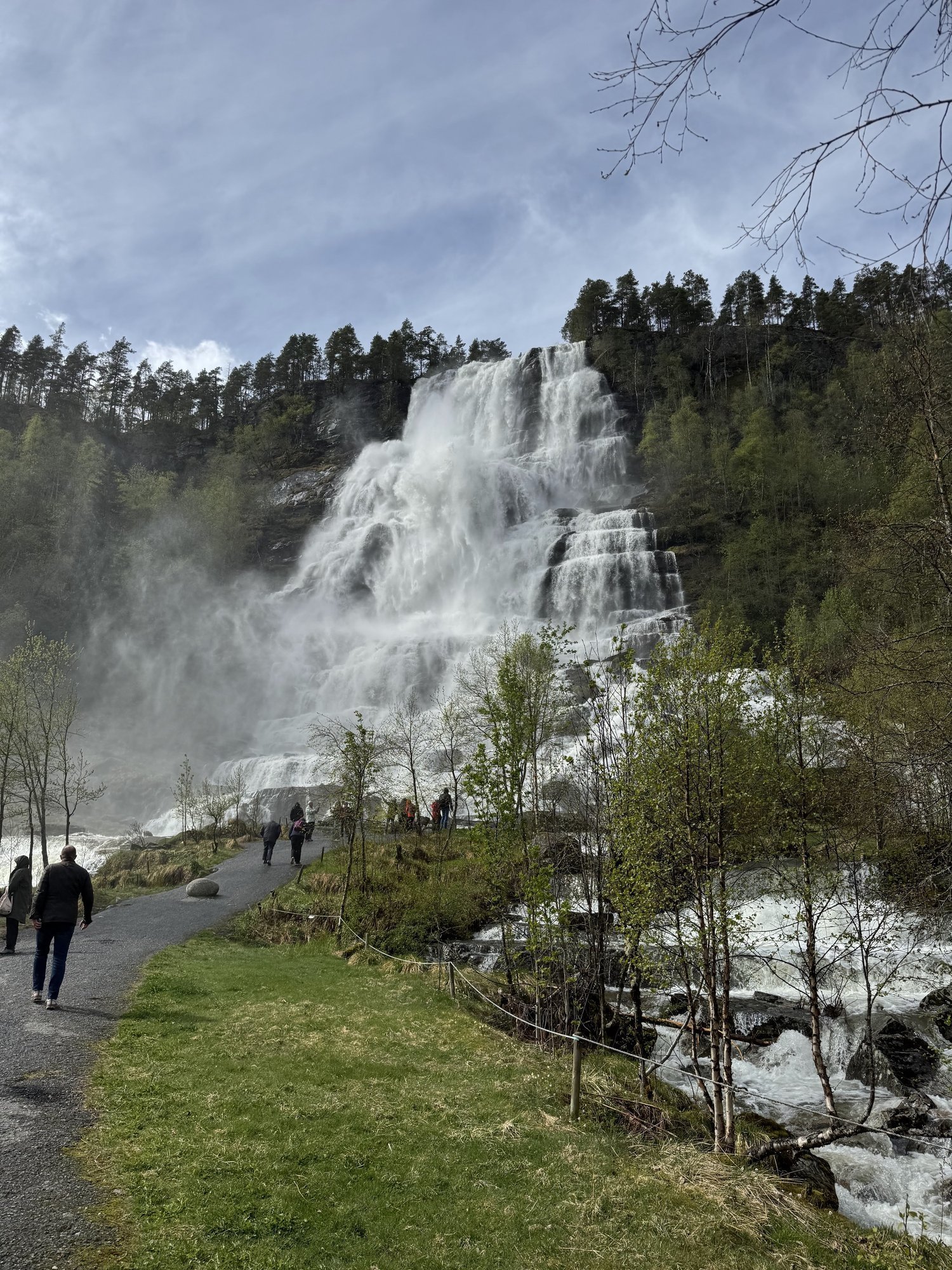
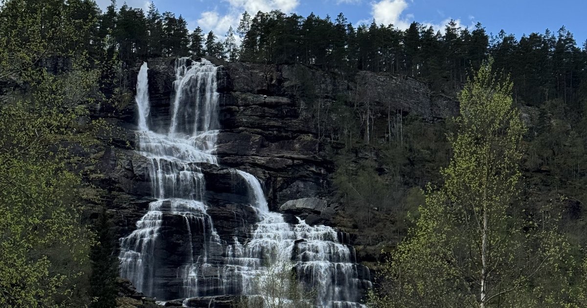
Tvindefossen falls about 116 meters over a wide rock wall, in two main drops. You often see the figure 152 meters, but that is the length the water runs down the cliff, not the height. The name is often linked to tvinne, “double”, after the twin streams. On sunny days the spray makes small rainbows — a classic photo stop between Voss and Flåm.
The waterfall is right beside the E16, with a campsite and a small kiosk next to it. Local legend says the water keeps you young.

Tvindefossen, the first stop on the road from Voss. Photo: Zayera Khan
Legends, food and hydropower
Trolls and stone
Large boulders lie scattered across the valley. Local folklore says they are trolls who turned to stone when the sun caught them.
Vossakjøt — cured meat from Voss
The local meat producer makes traditional smoked and salted meat, such as lamb sausages for Christmas. Preserving meat this way is a very old tradition in Norway.
Hydropower
Two hydroelectric power plants run in the Vinje valley. Together they make Voss an important producer of renewable energy in the region.
Education and festivals
Voss offentlege landsgymnas opened in 1916. It was Norway’s first public rural upper-secondary school (landsgymnas), made for young people from the countryside. Voss also hosts many festivals:
- Vossajazz — international jazz festival, held every spring since 1974
- Osafestivalen — folk and classical music in honor of the fiddler Sigbjørn Osa
- Ekstremsportveko — one of the world’s largest extreme sports festivals
- Voss Cup — football tournament for young players
- Smalahovesleppet — a celebration of the local dish smalahove, sheep’s head
Bømoen — from military camp to adventure
About 4 km from Voss, Bømoen was a military camp from 1898 to 2008. Today it is a base for skydivers and outdoor sports. The flat ground makes a natural airfield, and one of the most photogenic in western Norway.
I wrote a separate post about the place: Bømoen, where ice shaped the land.
Voss Gondola and Hanguren
The Voss Gondola opened in 2019. It takes you from the train and bus station in Voss to Hangurstoppen at 820 meters in under nine minutes. At the top there is a restaurant and hiking trails, and in winter the gondola is the way up to the ski area.
If you want to walk instead, read about my hikes from Voss up to Hanguren and from Hanguren to Vådalseggi.
Slate, rock and wildlife
Voss Skiferbrot, Noralem
Slate has been quarried in Voss since the 1300s. Production peaked in the late 1800s, when a new slate-cutting tool made the work faster and the quarry had over 400 workers. Today only one craftsman keeps the tradition alive.
Geology and wildlife
The bedrock around Voss is phyllite, anorthosite, granite, gneiss and quartzite. In the forests and mountains you can see elk, red deer, roe deer and reindeer. The rivers have salmon, trout, char and eel.
Oppheim — lake, church and ski jump
Oppheim lies northeast of Voss. It is known for a summer ski jump from the 1940s, one of the oldest in Norway, with a surface that allows jumping all year.
Oppheim Church is a wooden church from 1871, on the shore of Oppheimsvatnet. It was designed by Ole Vangberg, who used his plans for the nearby Vinje Church.
Oppheimsvatnet is rich in trout. Around the lake are old summer farms (støl), where cows and goats were once milked every day for butter and cheese.
Haugsdal and Stalheim
Haugsdal
Archaeologists have found tools here from around 800 AD. The white mountains are made of anorthosite, a rock rich in aluminum, and only a few plants grow on it — among them some rare alpine flowers.
Stalheim
The historic Stalheim Hotel opened in 1885 on the old postal road between Oslo and Bergen. The hotel you see today was rebuilt after a fire, but the view is the same.
Below the hotel runs Stalheimskleiva, built 1842–1846, with 13 hairpin bends. It is one of the steepest roads in Northern Europe. The road is only open in summer, and Visit Voss reports restoration work on the upper part with no car access for now. Walkers can use the marked path on Kongevegen.
Jordalsnuten and art in the valley
Painters such as Johan Christian Dahl and Georg Anton Rasmussen painted this landscape. Dahl’s View from Stalheim (1842) is in the collection of the National Museum in Oslo. Near the hotel, the Stalheim Folk Museum shows old farmhouses from the time of the postal road.
The full story, including the dark chapter of the Second World War, is in my post about Stalheim, its history and its view.
Through the tunnel to Gudvangen
The road goes through the Gudvanga Tunnel, 11.4 km long and opened in 1991. It takes you from the mountains down to sea level.
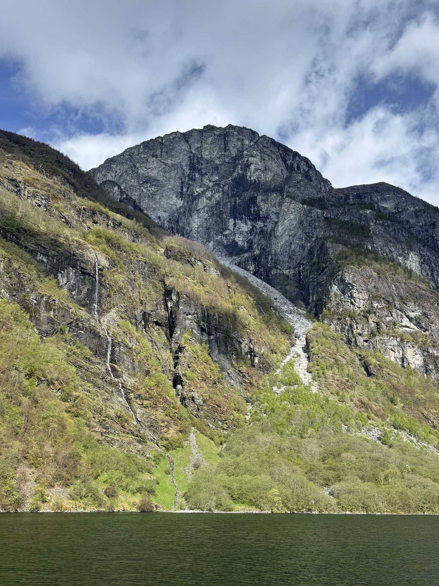
Gudvangen is a small village of about 100 people. Its name is often explained as “the god’s field”, and it became a tourist stop already in the 1800s. Today it is the gateway to the Nærøyfjord, which is on the UNESCO World Heritage List as part of the West Norwegian Fjords, together with the Geirangerfjord. From here, fjord boats sail to Flåm and Undredal.
For the boat trip, read my Nærøyfjord boat tour guide.
Flåm and the Flåm Railway
Flåm means “a meadow between steep mountains”. The village lies at sea level, with cliffs of more than 1,200 meters around it. Tourism started in the 1800s, when British and German visitors came by steamship.
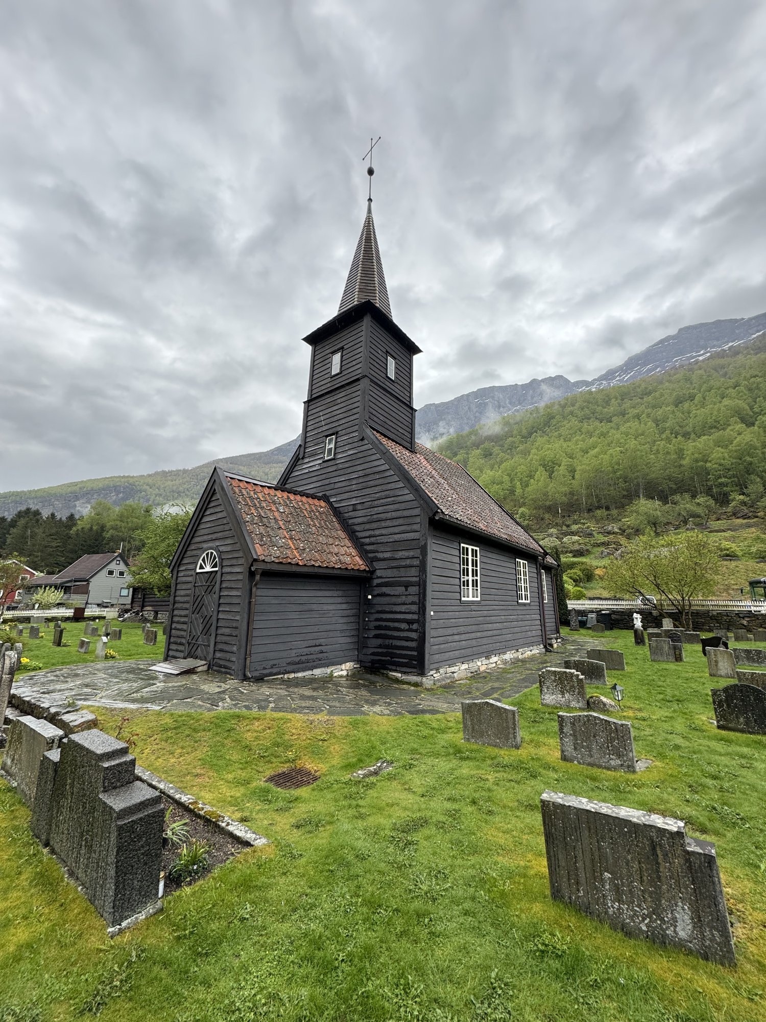
Flåm Church
The small wooden church was built in 1670. There was a church on the same site already in the 1300s.
The Flåm Railway (Flåmsbana)
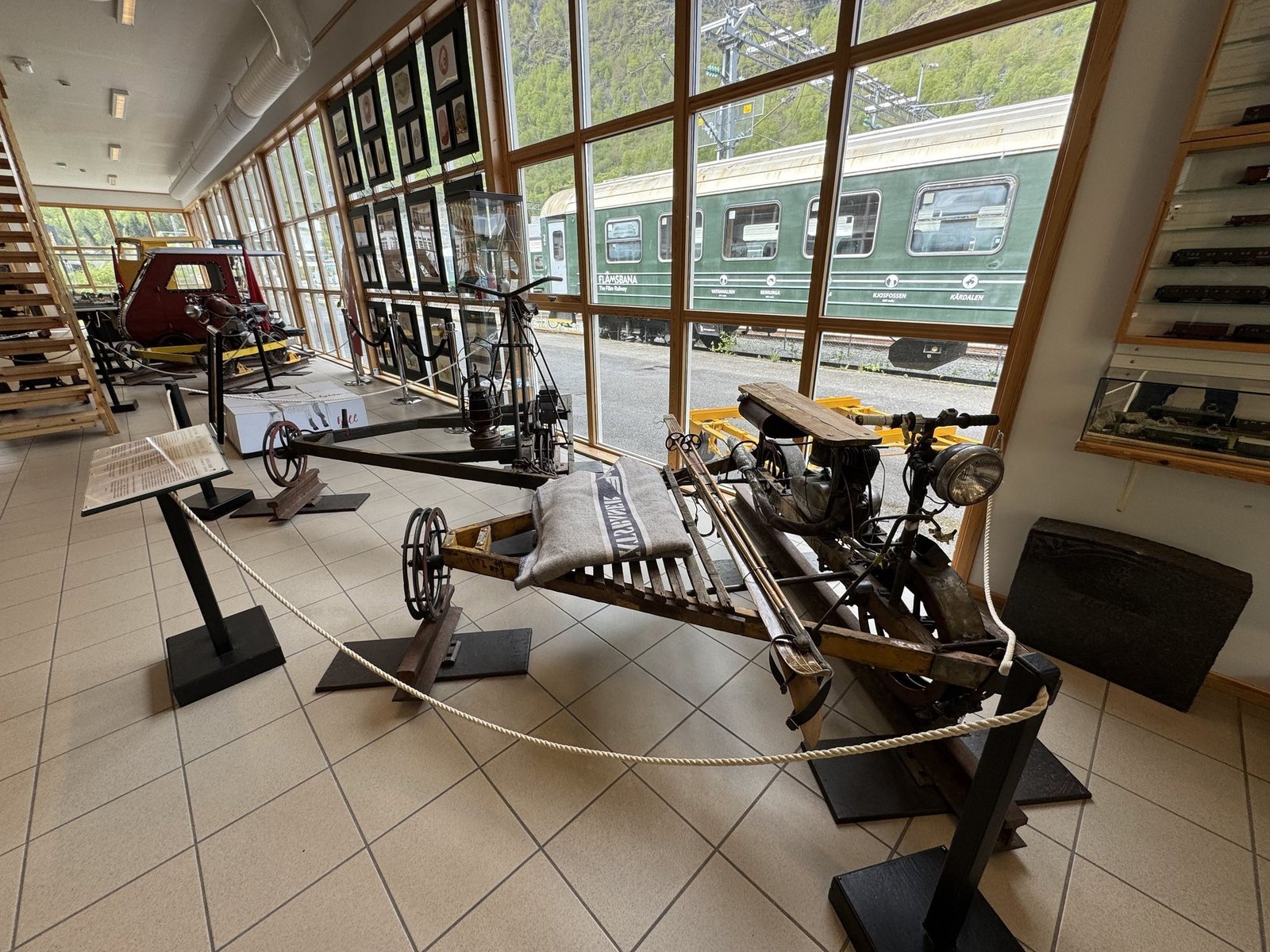
The Flåm Railway opened between 1940 and 1944. In about one hour it climbs 20 km from sea level to 865 meters at Myrdal, with a gradient up to 5.5 percent. That makes it one of the steepest standard-gauge railways in the world. The line has 20 tunnels, together about 6 km, most of them dug by hand. From the big windows you see waterfalls, rivers and mountain farms.

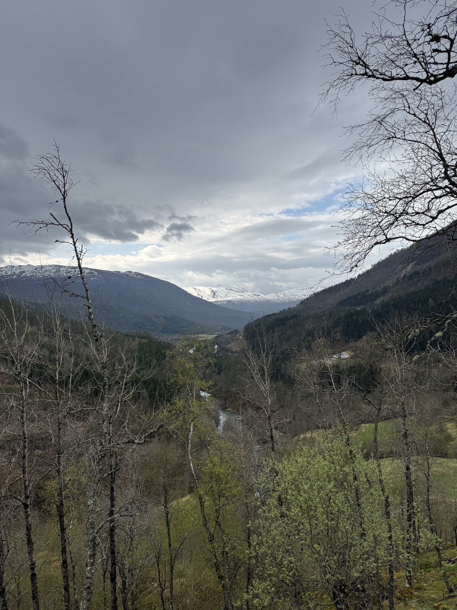
The Flåm valley from the train, with snow still on the peaks in spring. Photo: Zayera Khan
Self-guided plan: stop by stop
1. Voss — start point
- Why stop: food and fuel, a walk by the lake, or the gondola for an early view.
- Map pin: Voss Station / Voss Gondola base — 60.6291, 6.4101
- Tip: on a clear day, ride the gondola up to Hanguren for coffee and the view, then continue on the E16.
2. Tvindefossen — roadside waterfall
- Access: signposted stop right beside the E16, about 12 km north of Voss, with parking opposite the falls.
- Map pin: Tvindefossen car park — 60.7264, 6.4864
- On site: a short, flat path to the viewpoint. Expect spray when the river is high.
3. Stalheim — historic viewpoint
- Access: a short detour from the E16 to the terrace of Stalheim Hotel, with the classic view into Nærøydalen.
- Map pin: Stalheim Hotel viewpoint — 60.8352, 6.6808
- Note: drive Stalheimskleiva only when it is officially open. Check Visit Voss before you go.
4. Gudvangen — gateway to the Nærøyfjord
- What to do: a fjord cruise to or from Flåm through the narrowest part of the Nærøyfjord. Combine it with a bus or train for a loop.
- Map pin: Gudvangen ferry quay — 60.8807, 6.8429
- Road note: the E16 has long tunnels here, among them the Gudvanga Tunnel (11.4 km).
5. Flåm — fjord village and railway
- Map pin: Flåm Station — 60.8631, 7.1139
- Do not miss: the Flåm Railway up to Myrdal. Book ahead in the high season.
6. Myrdal — optional mountain junction
- Map pin: Myrdal Station — 60.7383, 7.1231
- Loop idea: take the Flåm Railway up to Myrdal and change to the Bergen Line towards Voss, Bergen or Oslo.
Suggested day plan
- Morning in Voss: gondola up and down, 60–90 minutes
- Tvindefossen: 20–30 minutes
- Stalheim viewpoint: 20–30 minutes
- Fjord cruise Gudvangen–Flåm: about 2 hours (check the timetable)
- Flåm: 2–3 hours for the railway, a café and a short walk by the fjord
- Return: train or bus, depending on your loop
Practical tips, accessibility and sustainability
Practical tips
- Road and safety: expect many tunnels, changing light and changing speed limits. Check road reports before you leave, especially in winter.
- Tickets: book the Flåm Railway and the fjord cruise ahead in the high season.
- Respect the sites: park only in marked places. In the UNESCO fjord landscape, stay on the paths and leave no trace.
- Weather: coast and mountains mix here. Bring layers and rain gear, even when the forecast is sunny.
Accessibility
- Tvindefossen: short, mostly flat path, with uneven gravel near the closest viewpoint.
- Stalheim terrace: level terrace. Inside the hotel there can be steps, depending on the entrance.
- Flåm Railway: ask about step-free boarding and accessible carriages when you book.
- Fjord boats: most modern boats have a ramp. Always check with the operator.
Sustainability
- Use the train for part of the trip (the Flåm Railway and the Bergen Line), and choose fjord boats with modern, low-emission engines.
- Bring a reusable bottle, and stop only in marked lay-bys to protect the plants along the road.
What is my verdict?
On the map, Voss to Flåm is only an hour. In reality it is a full day — a waterfall, a hotel terrace with a view that painters could not leave alone, a tunnel down to the sea, and a train that climbs almost straight up the mountain.
Drive it slowly. Which stop will you stay at longest?
Sources: Visit Voss: Tvindefossen; Visit Voss: Stalheimskleiva; Visit Voss: Voss Gondol; Store norske leksikon: Voss offentlege landsgymnas; Wikipedia: Tvindefossen; Wikipedia: Oppheim Church; Wikipedia: Flåm Church; Wikipedia: Vossajazz. Checked 30 September 2026.
The route in pictures