Fjords 101: How Norway’s Ice Carved the Coast
What is a fjord (geologically)?
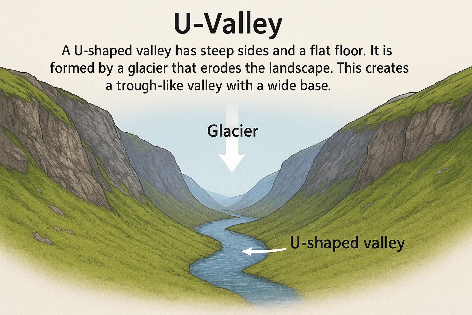
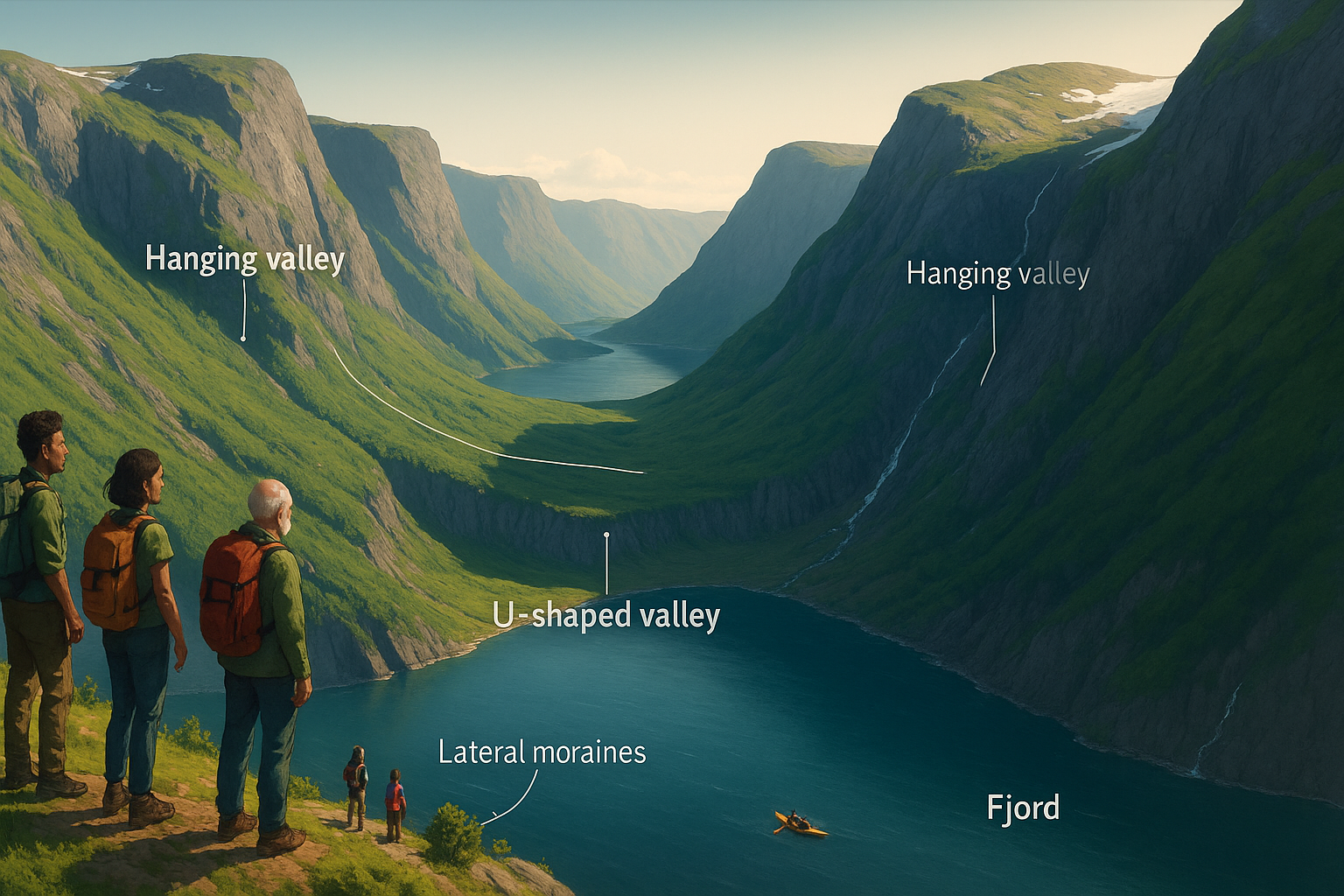
A fjord is a deep, U-shaped valley cut by glacial ice and later flooded by the sea. During the Quaternary (the last ~2.6 million years), ice sheets and outlet glaciers advanced and retreated many times, grinding bedrock and over-deepening valleys below sea level. When the last Scandinavian Ice Sheet melted at the start of the Holocene (~11,700 years ago), seawater rushed in—creating the fjords we see today.
How long did fjords take to form? How “old” are they?
Carving phase: Mostly over hundreds of thousands to a few million years, across multiple glaciations. In places, total glacial erosion reached ~2 km of rock removal.
Final flooding: The modern seawater-filled fjords are Holocene features—flooded as the ice sheet retreated ~11,700 years ago.
Why some fjords have “sills”
Geologists distinguish:
Threshold (silled) fjords: A shallow “doorstep” at the mouth formed where glaciers thinned and eroded less near the coast. These sills can restrict deep-water renewal and, in some basins, allow hypoxia to develop.
Open fjords: No prominent sill; deep water exchanges more freely with the sea, improving oxygenation.
Norway by the numbers
How many fjords? Norway has well over 1,000 fjords. Counts vary with definitions (whether small branches are included): about ~1,190 to ~1,700+ named fjords are commonly reported.
Longest & deepest (headline facts):
Sognefjorden: length measured ~205–226 km (method-dependent); max depth ~1,303 m.
Hardangerfjorden: ~179–180 km long; ~830–860 m deep.
Two flagship fjords
Sognefjorden (Vestland) – Norway’s longest and deepest fjord, with a classic over-deepened profile and a deep inner basin. Length and depth vary by how you measure, but authoritative Norwegian sources list ~226 km and 1,303 m respectively.
Hardangerfjorden – A long, branching fjord system cut along structural weaknesses in the bedrock; modern depths exceed 800 m and the main trough extends ~180 km inland.
Wildlife in and around fjord regions
Fjord ecosystems mix deep, cold basins with productive surface waters—home to:
Marine mammals: Harbour porpoise (common along fjords/coast), killer whales (seasonal), plus harbour and grey seals in coastal colonies.
Seabirds & raptors: White-tailed eagles are widespread along the Norwegian coast and fjords.
Cold-water corals: Several Norwegian fjords (e.g., Trondheim Fjord) host Lophelia coral reefs—among the world’s densest cold-water coral occurrences—creating habitat “hotspots” on sills and slopes.
Note on oxygen: Deep, sill-separated basins can become oxygen-poor; this shapes which animals thrive at depth.
Key takeaways
Fjords are glacial landforms—over-deepened valleys cut by ice, then flooded by the sea.
Timescale: Carved over multiple glaciations (hundreds of thousands to a few million years); seawater flooding ~11.7 ka.
Types: Threshold (silled) vs open fjords, with big consequences for deep-water oxygen and ecology.
Scale: >1,000 fjords in Norway (definition-dependent). Sognefjorden and Hardangerfjorden headline for length and depth.
Sources & further reading
Geological Survey of Norway (NGU): Glacial landforms & fjord sills.
Deglaciation timing across Fennoscandia (ice-retreat chronologies).
Store norske leksikon (SNL): Norway’s longest fjords (lengths/depths).
NASA Earth Observatory: Hardangerfjorden imagery & depth notes. E
Institute of Marine Research (IMR): Harbour porpoise; harbour & grey seals.
BirdLife / VKM: White-tailed eagle status in Norway.
Lophelia.org & research groups: Cold-water coral reefs in Norwegian fjords.
Illustration: ChatGPT / OpenAI, based on geological sources (general geomorphology of fjords and U-valleys).